Newfound Gap Road
Carlos Campbell Overlook
Chimney Tops
Scott just had to throw a few snowballs! Two days before we headed over the Great Smoky Mountians the road was closed due to a foot of new snow!
Eastern Hemlock
A view of the road - there wasn't any snow on the highway. Thank goodness, we were pulling the trailer on this trip!
The Newfound Gap Road is the only paved route over the Great Smoky Mountains. It stretches for 31 miles from Gatlinburg, Tennessee to Cherokee, North Carolina and climbs from an elevation of 1300 feet to 5046 at Newfound Gap. The road looks snow covered in this picture as it winds through this pass.
Looking to the roadway above us...
Icicles in a cut along the road. We drove the road with our trailer on March 31st and we returned the next day; by the end of the second day most of the ice was gone!
Newfound Gap
Good view of the road we drove to Newfound Gap.
Several views of the Newfound Gap overlook - in this one you can see the road again.
Oconaluftee Valley Overlook
This is how I'll remember the Great Smoky Mountains. Beautiful.
Cataloochee Valley
In 2001 the National Park Service released 25 elk back into the Great Smoky Mountains. Elk once roamed the region but were eliminated by over-hunting and loss of habitat. The last elk in North Carolina was believed to have been killed in the late 1700s. In Tennessee, the last elk was killed in the mid-1800s.
Appalachian Trail
The Appalachian Trail is 2,160 miles extending from Maine to Georgia. I get to walk a little piece of it here in Tennessee.
We could see footprints in the snow but the trail was ice-covered, snowy, and muddy in most places. We did talk to a Grandfather/Grandson pair that were going to try to hike a little ways on the trail when we were stopped at Newfound Gap.
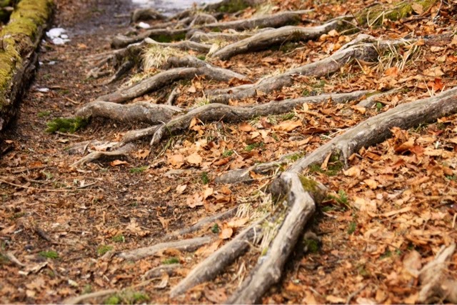
Exposed roots from thousands of feet trekking the trail.
Another icicle-covered cut as we drive the 7-mile road to Clingmans Dome.
Clingmans Dome
Clingmans Dome is the highest point in the Smokies at 6643 feet.
Can you see the airplane? I was looking down on it!
Little Pigeon River
Spring Beauty
Cades Cove
Cades Cove Loop Road is an 11-mile one way road where we saw wildlife and many historic buildings. A "cove" in Smoky Mountain vernacular is a relatively flat valley between mountains or ridges. This cove is unique to the national parks system because it blends the natural and cultural treasures of the Southern Appalachian Mountains.
John Oliver Place
The John Oliver Place is one of over 80 buildings in the park. Built in the 1820s, the John Oliver cabin is the oldest log home in Cades Cove. It remained in the Oliver family until the park was established more than 100 years later. Large families often lived in such small buildings. Usually parents, infants, and daughters slept on the first floor and sons slept in the loft.
Road to the Primitive Baptist Church.
Primitive Baptist Church
This Primitive Baptist Church was first made of log until it was replaced with this building in 1887. The church was quietly closed during the Civil War. Church correspondence after the war explained it all: "We the Primitive Baptist Church in Blount County in Cades Cove, do show the public why we have not kept up our church meeting. It was account of the Rebellion and we was Union people and the Rebels was too strong here in Cades Cove. Our preacher was obliged to leave sometimes, and thank God we once more can meet."
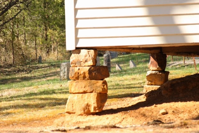
Church foundation
The daffodils in Cades Cove were planted in the 1930s when the CCC (Civilian Consevation Corps) was building trails, roads, and bridges in the park.
Methodist Church
J.D. McCampbell, a blacksmith and carpenter, built this church in 115 days for $115. He later served many years as its minister. Notice the two front doors, this usually indicates that the church follows the custom of men sitting on one side of the church, women on the other. The two doors are here because the church borrowed building plans from another church that did divide its congregation by gender.
Missionary Baptist Church
A group of Baptists expelled from the Primitive Baptist Church because they favored missionary work formed this church in 1839.
Looking out the window to the cemetery.
Church foundation
We saw lots of deer in the park.
More CCC daffodils.
Cable Mill Area
Split rail fence
Visitor Center chimney
Cable Mill
Wooden flume that carries water to the mill wheel.
The mill wheel isn't running properly and the mill is closed because vandals did some extensive damage over the winter. Notice the log foundation.
Cable Mill, a water-powered grist mill and sawmill, was built by John P. Cable in about 1870. The same wheel provided power for both mills.
Gregg-Cable House
Leason Gregg bought an acre of land from John P. Cable in 1879 and built the first all-frame house in the cove with lumber sawed at Cable's mill.
Sorghum mills were used to squeeze sugary juice from stalks of cane.
More deer.
Dan Lawson Place
The brick chimney on this house is unusual for the time and locale. The bricks were made on site.
Tipton Place
"Col. Hamp" Tipton had this house built in the early 1870s for his daughters, Miss Lucy and Miss Lizzie, who taught school in Cades Cove.
Looking through the corn crib doorway to the cantilever barn.
Corn crib door; the spaces between the logs helped dry the corn.
Cantilever barns were built with the large overhang because owners were taxed by the footprint of the barn. Large barn + small footprint = fewer taxes! The drive-through area of the barn was often used to store the wagon.
Carter Shields Cabin
A wound suffered in the Battle of Shiloh left Carter Shields crippled for life. He bought this property in 1910 but only stayed 11 years before moving from Cades Cove. You'd think an old soldier could find contentment in such a peaceful setting.


No comments:
Post a Comment